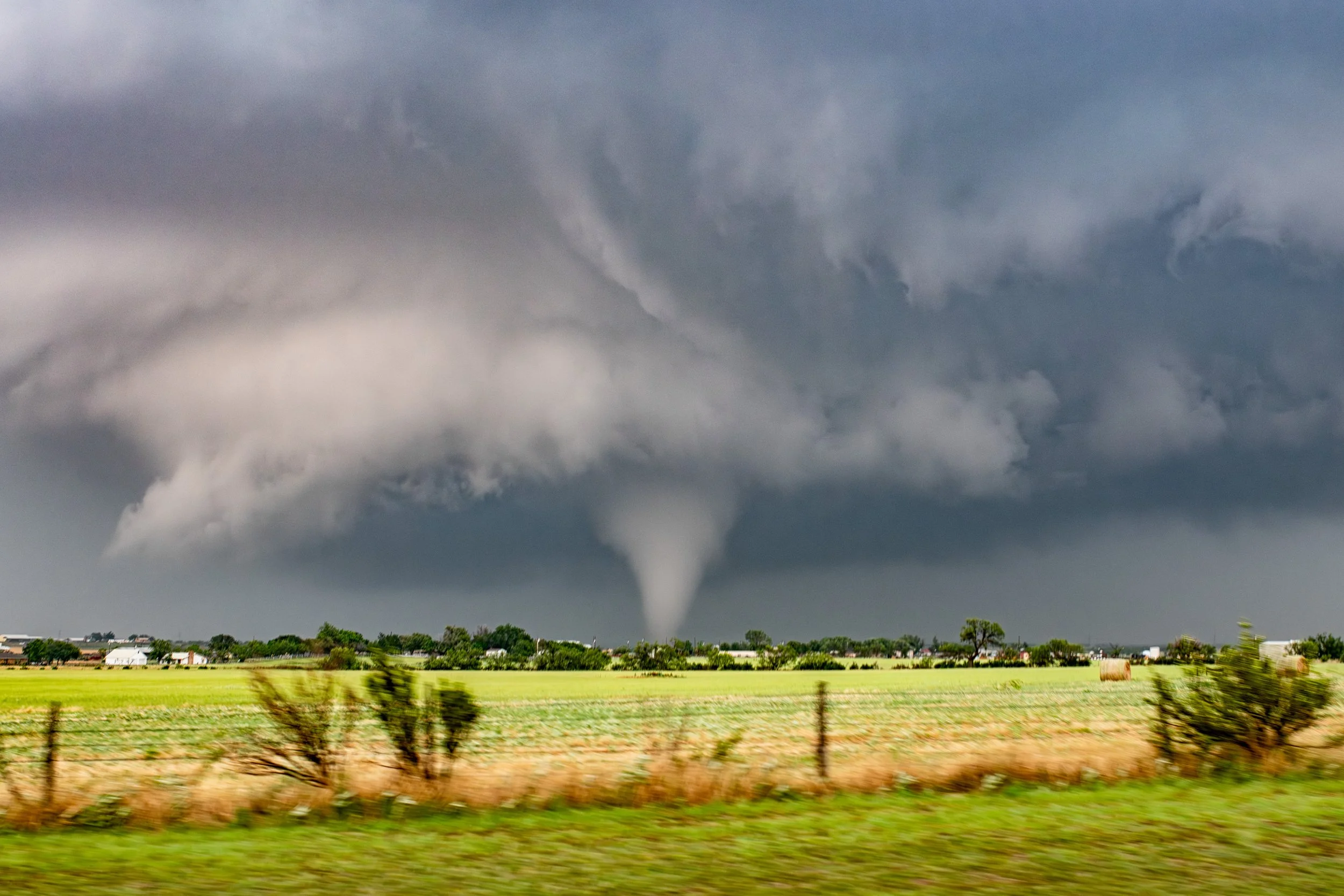
A Tornado Dances Across the Texas Landscape by Jessica Moore
You truly never know what to expect on any given chase day, but this particular day in May of 2024 offered its fair share of surprises…
A photogenic tornado churns along the Texas prairie just northeast of the town of Windthorst, Texas on May 25th, 2024
The anticipation that builds in advance of any given chase day is something that can’t be fully captured in words. It starts as a slight pit in your stomach, a little knot of anticipation and heightened senses.
May 25th, 2024 began with a Moderate Risk for severe convective storms as issued by the Storm Prediction Center, along with a 15% hatched tornado risk.
I had chased storms the day prior near Thackerville, Texas so I was already positioned within reach of the southern portion of the hatched risk area. Given my concerns for upscale growth of storms that might favor a clustered or linear storm mode further to the north, I liked my chances for more isolated storms further south anyway.
I began the day’s chase near Olney, which is southwest of Wichita Falls. Initially some high-based storms formed here, which became severe and gradually became more surface-based.
We tracked the storms from Olney through Archer City, then east toward Windthorst. Check out the progression of images below. I always love marveling at the visual evolution of these powerful storms.
The storm begins to organize and intensify near Olney, TX.
A powerful mesocyclone and associated wall cloud develops as we drive eastward on TX HWY 25 toward Windthorst.
It was roughly around this time when my driver and I were impacted by strong winds and small rocks and debris from a weak tornado that was passing over the highway just above our heads. We were, of course, unaware of it, and we lost two out of three of the windows on the left side of my vehicle.
The driver’s side window was among those shattered, and it made for quite hazardous driving. Not only was the driver’s visual of the storm and the left side of his viewing area totally obscured via shattered glass, but we were worried about it breaking all over him as he was driving.
Thankfully, the window was actually sucked OUT of the window as one whole piece due to the fact that we had taped it with masking tape in an attempt to stop it from shattering.
Wild times! We were determined to continue chasing.
The tornado first touches down northeast of Windthorst, TX at about 5:15pm CDT.
Here, I had to climb into the back seat of my car so that I could shoot images of the tornado as it developed just northeast of town out of the back window.
Passing through Windthorst, we had occasional glimpses of the tornado in between houses and trees.
As we continued to trudge eastward behind a neverending conga line of storm chaser cars going frustratingly below the speed limit, I finally began to get unobstructed views of the tornado, and it was so photogenic.
Here is a little more of an artsy shot of it.
This was about the biggest the tornado became before dissipating rather quickly after this. Unfortunately, we were never able to get to a stopping point to capture higher-quality images that were not taken from a moving vehicle, so these images will have to suffice!
I thought this scene of the turbulent clouds on the backside of the storm was absolutely stunning. I love looking for scenes like this; I found it rather cinematic.
Ultimately, despite its share of challenges and frustrations between the shattered windows and storm chaser convergence we had to fight, May 25th ended up producing the most photogenic tornado that I saw in 2024, and I’m grateful that there was no reported loss of life or destruction of property with that amazing storm.
Written by Jessica Moore


